LAMEX 1 | At the 79°N Glacier: instruments recovered, and a solar eclipse
Sunday, August 23rd, 2026
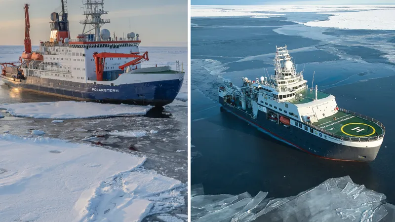
After leaving Longyearbyen on 9 August, RV Polarstern set a westerly course across Fram Strait and pushed into the sea ice off Northeast Greenland. Here we arrived in the first working area of the LAMEX 1 expedition, within sight of a small group of islands, with the Greenland coast behind them, the 79°N Glacier and snow-covered mountain tops in the distance.
A year of data, collected by helicopter
Last year, colleagues on expedition PS150 (EGC-Sources) left instruments behind in this region. They have been recording ever since, through the winter ice and the polar night, and we had come to collect them. Reaching them meant flying: with the ship's helicopter, three seismological stations were recovered from land, one GNSS station was retrieved and a second was serviced so that it can carry on measuring. The helicopter also flew ice reconnaissance for us. From the air, the leads and the weak points in the ice cover can be seen far beyond the range of the bridge, and it is these flights that allow the ship to pick an efficient route through dense ice instead of forcing her way through it.
Greenland is rising
A GNSS station is, in essence, a very precise satellite receiver bolted to bedrock. What it measures is the height of the ground itself. Greenland is losing ice on an enormous scale, and as that weight is taken off, the crust beneath slowly rebounds upward – a process known as glacial isostatic adjustment. The uplift is small, a matter of millimeters per year, but it has to be known accurately, because the loss of the Greenland Ice Sheet is calculated from measurements that include this movement of the ground. Only by separating the rising rock from the vanishing ice can the true mass loss of the ice sheet be determined – and it is that ice loss which is currently driving global sea-level rise.
Listening to the ice
A seismological station consists of little more than a seismometer, sheltered from wind and snow beneath a large bucket, with a data logger and a box of batteries alongside. What they record is not only the small earthquakes that occur in Greenland as the land rebounds. Ice makes noise too. Glaciers grind forward, icebergs calve and drift, pressure ridges build up where floes are pushed against one another – and each of these events sends a signal through the ground and the ice. A full year of such recordings is a continuous account of how the ice in this region behaves, in a place where almost nobody is present to watch it happen.
When the ice changes its mind
For the whole approach, the ice had looked stable. Within a single day it was a different sea. Two targets were left in it. At the first, where we wanted to land on the ice to download the data from an oceanographic mooring and to recover a buoy, no floe was solid enough to set the helicopter down on. At the second, the opposite had happened: water that had been open until then had closed, and a thick, impenetrable floe now lay directly above the mooring, putting it out of reach. One of the coming expeditions to this region will have to collect them.
Polar bears, and a darkening sun
The landscape here offers more than beautiful ice formations. Whales appeared again and again, and over three days more and more polar bears – this stretch of coast is important denning habitat, where many cubs are born and spend their first months. One female with her cub stayed near the ship for a long time, entirely unbothered by the many pairs of eyes on deck, and could be watched teaching the cub how to break a hole into the ice.
Then, on the evening of 12 August, the solar eclipse. The weather had been dull and overcast all day, but right on cue for the spectacle the sky opened and the sun stood against a brilliant blue. Everyone who was not needed to run the ship was out on deck. Off Northeast Greenland we lay very close to the band of totality, with about 99.5 % of the sun covered, and the peak was something you could physically feel: minutes beforehand it grew noticeably cooler, the light drained out of the sky, and the calls of a few puzzled birds carried across the ice. Then the moon moved on, and it became bright and warm again. Many stayed outside long afterwards, with the Greenland coast in front of them and the sea ice glittering in the sun. Were we perhaps the northernmost observers of this eclipse?
Where we go next
With the last helicopter flight, the planned work in this area is done. Polarstern has turned back east into Fram Strait and is now heading north. Waiting there are ocean bottom seismometers and oceanographic moorings, also deployed last year, that we intend to bring back on board.
Follow LAMEX 1:
Cruise blog on the RV Polarstern website:
AWI expeditions website: